Island Pag
Island Pag - Croatia, towns Novalja, Stara Novalja, Pag, Gajac, Mobile homes Pag, Strasko, Simuni, Apartments Pag, Kvarner, Croatia
PAG, an island in the north-Dalmatian archipelago, third largest in Kvarner, situated between Kvarneric and the Velebit Channel, with a northwest-southeast extension; area 284,5 sq km; population 7,969 (around 60 km long, between 2 and 10 km wide). The south-western coast of the island is low, and the north-western is steep and high: the Pag Bay (with the large Caska Cove) and Stara Novalja Bay; the southeast of the island features three capes. The climate is Mediterranean. No surface water streams are found on the island; there are springs near Metajna, Novalja, Povljane and Pag. Most of the island is rocky; smaller areas are covered with Mediterranean shrubs. The southeast of the island contains karst lakes Velo Blato and Malo Blato. The island's highest peak is Sveti Vid (St. Vitus, 348 m).
Vine (zutica), vegetables and fruit are grown in the valleys and fields (Novaljsko, Kolansko, Povljansko, Vlasicko and Dinjisko). The area of the Lun peninsula (20 x 2 km) is mostly under olive-groves. Sheep rearing (cheese of Pag, wool) and viniculture also represent chief occupations on the island. Major places on the island are connected by a road and a 300m-long bridge built in 1968 (the length of the arch over the sea is 195 m), via Cape Fortica, Razanac and Posedarje with the main road. Ferry connection Prizna - Zigljen. Major ports and yachting marinas include Stara Novalja, Pag, Caska, Metajna, Dinjiska, Stara Povljana, Nova Povljana, Kosljun, Simuni, Mandre, Novalja and Tovarnele.
In the past Pag was inhabited by the Illyrian tribe called Liburnians (the ruins of a fort and a necropolis near Kolan, in Mihovilje near Novalja, in Dabor and Vidasov Kant); fields with tumuli from the Bronze Age lie between Kosljun and Simun. At the beginning of the 1st century at the latest, the Ancient Romans constructed a fortification system to defend themselves against Illyrian tribes: a large castrum Cissa (Caska), a port castrum Navalia (Novalja) and smaller forts: Kosljun above the Novaljsko field, Svetojasnica on the cape of the karst Zaglava. Apart from the forts, there were also larger (Pagus) and smaller Roman settlements (the ruins of a town in Tovarnele near Lun, in the fields Brbonovica and Lesandrovica, etc.).
The Croats inhabited the island early; their major settlement after their population of the island was Kesa (a part of which is included in today's Novalja). King Petar Kresimir IV donated (1071) the northern part of the island to the church of Rab; the southern part of the island became the property of Zadar. In the Middle Ages Pag was very often the scene of frequent clashes between the inhabitants of the island of Rab and those from Zadar. At the end of the 12th century, after the fall of Kesa, the old town Pag assumed the leading role on the island. - From 1409 to 1797 Pag was under the rule of the Venetian Republic, afterwards shared the same destiny as the rest of Dalmatia under the Austrian rule. After the German-Italian occupation in 1941, it fell under the Italian rule, afterwards occupied by the Germans. In 1945 the island was annexed to Croatia.
The old folk tradition has been partly preserved: tunes (following the same melody, the type of singing known as na kanat), both the heroic and the love ones, traditional dances (po starinski, po paski, the ring of Pag) in Pag and Novalja (po naski). Traditional arts of the island are the stitched lacework of Pag (the lacework school was founded in 1906) and the crochet lacework of Novalja.
Regardless of the weather conditions, the island is accessible through the Pag Bridge from Cape Osjak on the mainland (near Miletici) to Cape Fortica on the island (near Miskovici), 20 km from the town of Pag, the centre of the island. In winter, the bora blowing from Mt. Velebit can disturb the ferry schedule.
Stara Novalja
Since the ferry harbour was relocated to Zigljen (except in some extraordinary weather conditions), Stara Novalja has become a quiet place which offers accommodation facilities in private homes, as well as lodging and boarding services. As such it is preferred by families. The major event is the feast day of Sts. Peter and Paul (29th of June).
STARA NOVALJA, a village in the cove of the same name in the north-eastern part of the island of Pag, 5 km north of Novalja; population 234. Economy is based on farming, viniculture, fishing and tourism. The cove of Stara Novalja is the submerged part of the Pasko-Dinjiska valley. Its coasts are steep, with an exception of those on the south-eastern side, where the coast turns into the fertile Novalja field. The deepest point is at the entrance into the cove (38-47 m); toward the inner part the depth is lower, being 10.4-11.4 m near the south-eastern coast.
Stara Novalja is well-protected from both the bora and the sirocco. The safest dock for larger ships is located south of the cove called -Drljanda, where the depth reaches 27-38 m. Smaller ships and yachts drawing up to 3.5 m are docked along the external part of the jointed pier (in front of the village). Stara Novalja is located on the road (M29). In its vicinity are remains of antique walls, a late antique necropolis, ruins of the pre-Romanesque church of the Holy Cross.
Novalja
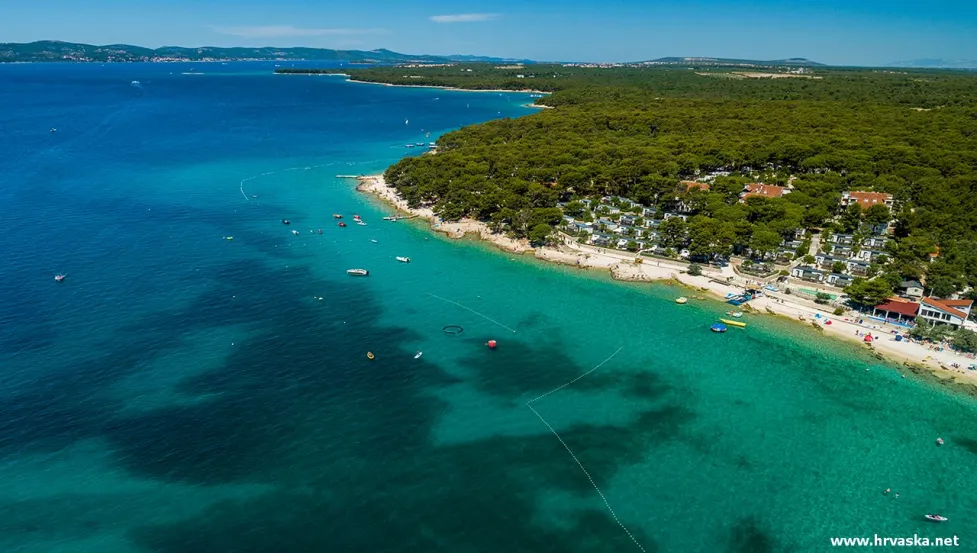
Situated in a warm cove between the groves of pine, it maintained the archaic Mediterranean ambience with the surroundings decorated with marvellous beaches: Zrce, one of the most beautiful Adriatic beaches, Caska, Strasko, Trincel, etc. Novalja has become an important tourist centre. Its offer includes hotels, campsites, modern houses, the residential and tourist resort Gajac, sports and recreational facilities (sports centre within the campsite Strasko), gastronomic delicacies (the cheese of Pag, lamb, domestic wine), cultural events - attractive local dance, valuable heritage, excursions by boat.
NOVALJA, a town and port in the bay of the same name, situated at the south-western coast of the island of Pag; population 1,912. The town includes the former hamlets Sveti Ante (St. Anthony) and Spital. In the Roman times (the ruins of the Roman aqueduct) there was a town called Cissa (the present hamlet of Caska) in the surroundings of Novalja. Novalja is a town of a compact coastal type which expanded considerably in the recent times. Chief occupations include farming, viniculture, livestock breeding, fishing and tourism.
The port of Novalja is well protected from the winds of the first and second quadrants; the westerly and north-westerly winds are extremely strong. When entering the port, larger vessels have to beware of the shallows (8.5 to 9.8 m) 1.8 southwest of Cape Vrtlic. The pier in the port provides shelter to smaller vessels; there is a 98-m long embankment made of rocks. Larger vessels can anchor at the entrance into the port off the north-eastern coast, and smaller vessels and yachts in the centre of the port, at a depth between 5 and 8 m. Situated on the regional road (29) running through the whole island.
Novalja developed on the site of the ancient settlement Novalia which represented the southern port of the Roman settlement Cissa (today Caska). From the Roman times parts of the aqueduct, several inscriptions and architectural plastic forms have been preserved. In the early Christian times there was a large basilica urbana in the centre of the town, with a semicircular apse and mosaics (remains of architecture, plastic forms, inscriptions). In 1971 two decorated reliquaries were found there: a bronze one from the 4th century and a silver one, from a later period. On the same place the church of the Blessed Virgin Mary in Gothic style was erected, annexed in the Baroque period, which holds the painting of Our Lady with Childfrom the 16th century. The present parish church of St. Catherine was built in 1906.
Pag
Tourism on the island of Pag has seen its boom in the last decades. A large, well-maintained public beach, particularly suitable for families with children, lies not far from the centre of the town. The former storehouses of the old salterns of Pag (one of them was redecorated into a discotheque) and mineral mud of Pag (on a location called Lokunja).
The famous lacework of Pag, the best-known national lacework, is produced here, and in the local cheese-monger's shop one of the most famous authentic national sorts of cheese - the cheese of Pag. The prominent national costumes are also categorized as national souvenirs. The present offer of Pag includes hotels, apartments, rooms, sports and recreational facilities (water sports in particular), cultural events, which - along with the impressive landscape - stone lace in the sea - make Pag and the Pag Bay an exquisite tourist resort. The vicinity of Karlobag, and the World Biosphere Reserve on Velebit Mountain, offer mountain enthusiasts and lovers of the mountain panoramic views to experience both a mountainous and a marine recreation in a single day.
The Assumption of Our Lady (15th of August) is commemorated by organizing a big local feast, and the summer carnival days, when picturesque masques can be seen, attract many guests.
PAG, a town and port on the south-eastern coast of the Pag Bay on the island of Pag. Situated in the south-western part of Krsina (263 m), where the Pag Bay continues through a narrow strait (Prosika) towards the southeast and ends in a shallow salt lake (Paska Solila); population 2,421. The inner part of the cove south of Cape St. Nicholas, where the port of Pag is situated, is shallow and muddy. A 50 m long and up to 4.5 m deep navigable canal represents the entrance in the port, which has an enclosed small port of a depth up to 2.9 m, and an embankment, along which the sea is between 3.6 and 4 m deep, south of the port. Larger vessels anchor along the eastern coast, at a depth between 24 and 38 m, 850 m far from the ruins of the chapel on Cape St. Nicholas. During fine weather conditions and in the summer months smaller vessels can anchor in front of the entrance in the navigable canal. Ships with a draught of up to 3.5 m land along the northern embankment, and boats land in the small port. Chief occupations include farming, viniculture, livestock breeding, fishing, shipbuilding, salt production and tourism. Situated on the main road (M29) running through the whole island.


